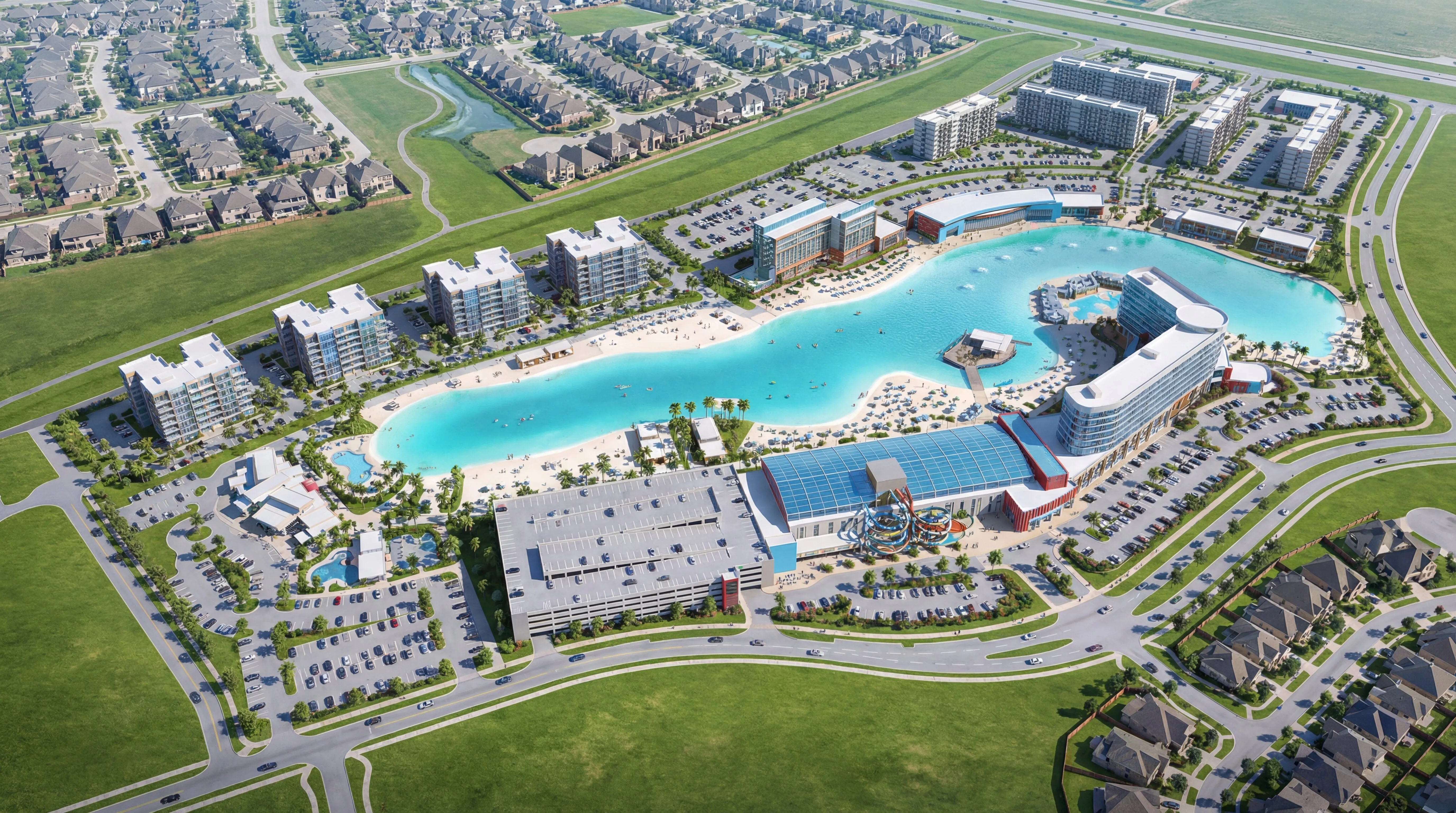
The Development
The project is located within a previously negotiated Planned Unit Development with established density and height restrictions. One of the central challenges was achieving the required unit counts and program intensity necessary to meet proforma return targets while operating within those regulatory constraints.
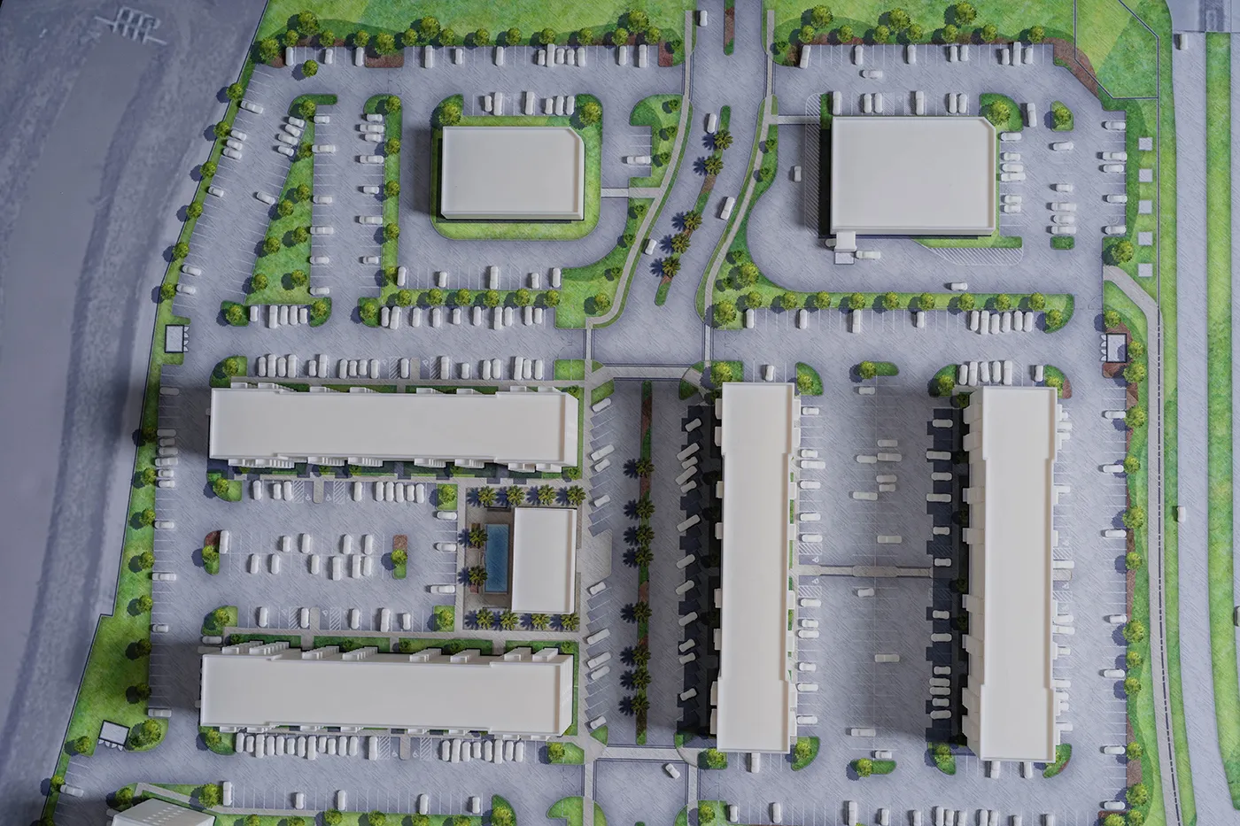
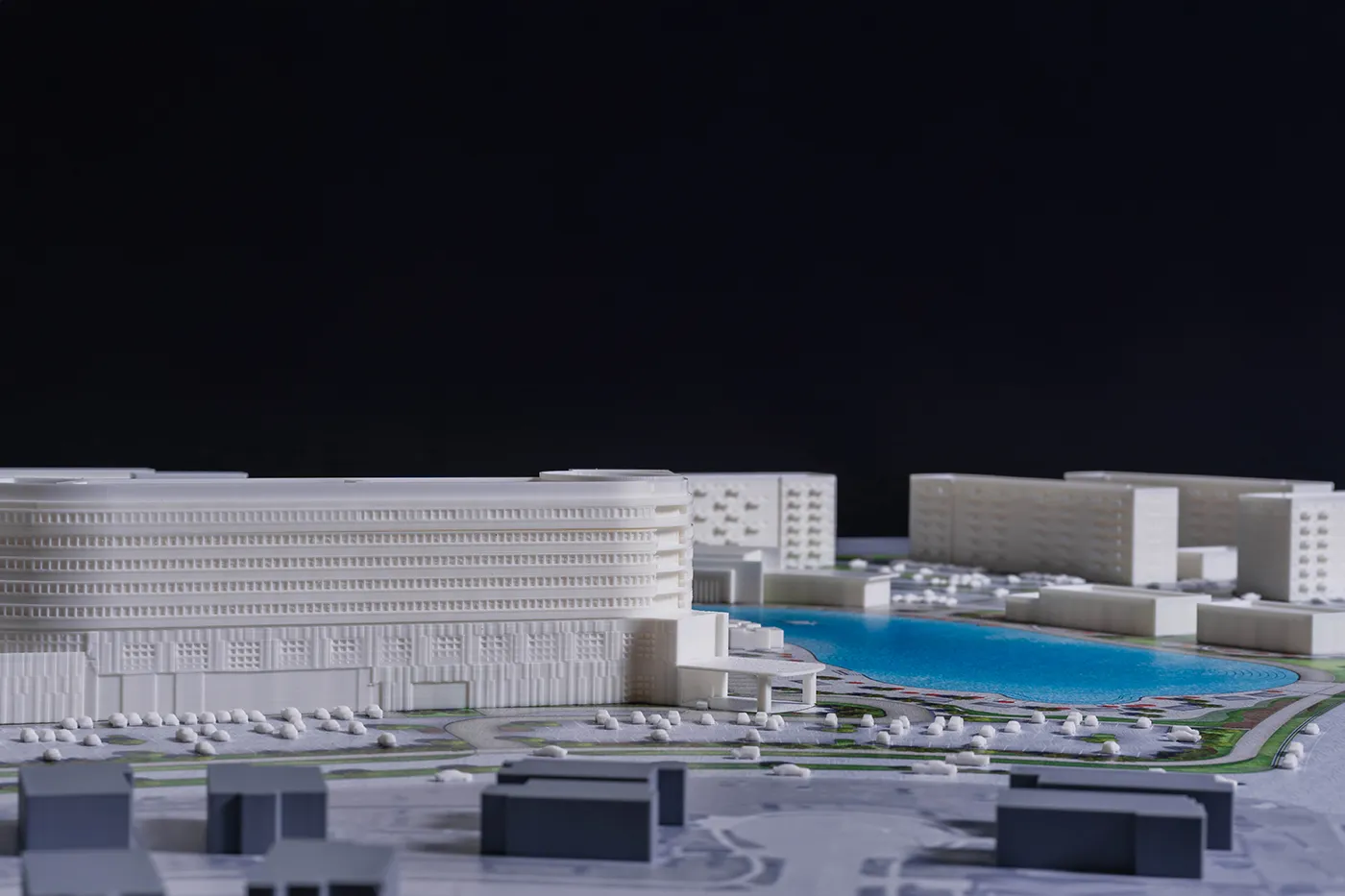
Maximizing parcel yield required close coordination with civil and land development engineers to clearly define buildable limits, adjacencies, circulation, and infrastructure capacity. Particular attention was given to view corridors. Buildings were positioned to maximize premium lagoon frontage and water facing units while preserving existing residential views into and above the adjacent neighborhoods.
The final massing strategy terraces development intensity across the site. Taller, higher density buildings are positioned along the water channel and freeway frontage, gradually stepping down in height as development approaches the lagoon and neighboring homes. This transition allowed the project to meet financial objectives while creating as many direct lagoon facing units as possible.
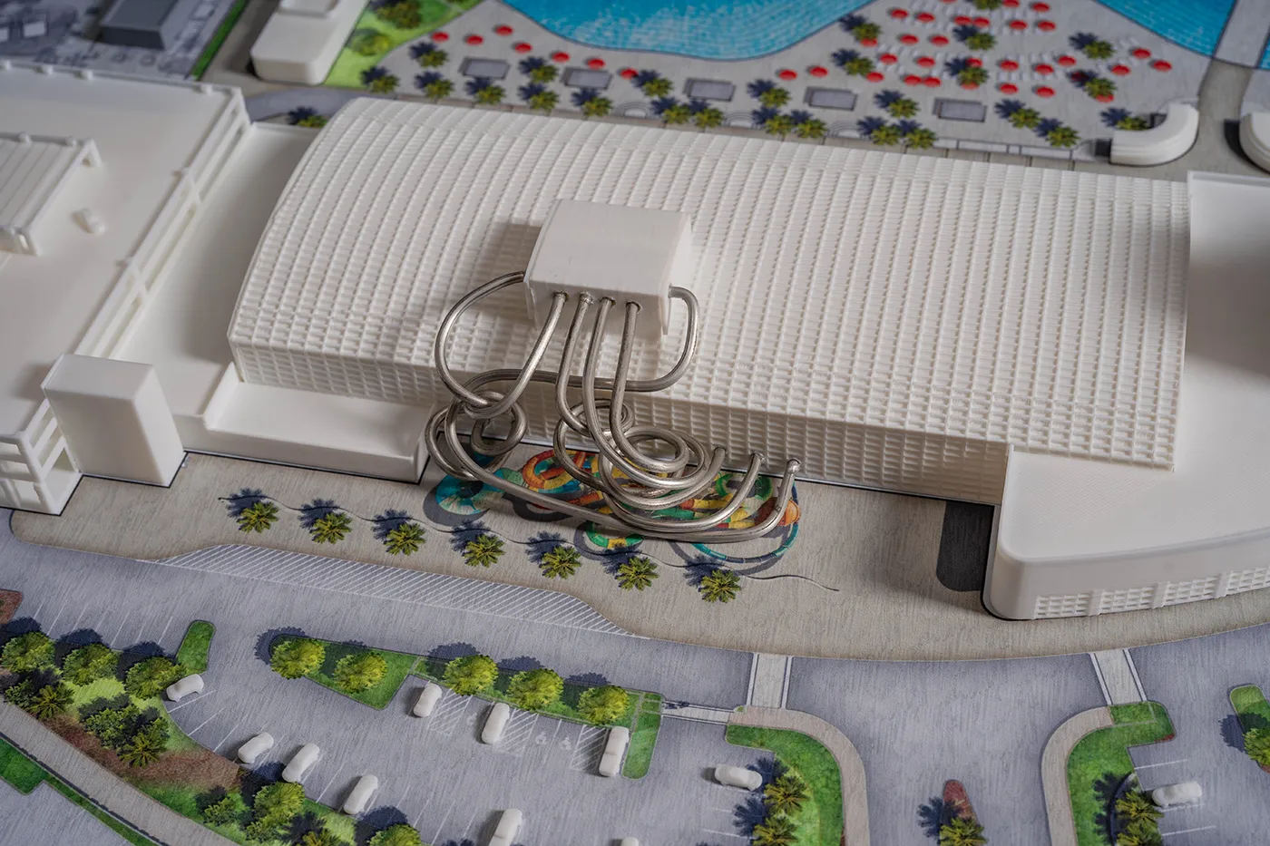
Concurrent with the financial modeling and phasing strategy, Project Luong prepared the project to go through municipal and county approvals. To effectively communicate the scale and architectural articulation of the development, we produced the largest physical 3D model in the firm’s history. A detailed site base was created, and each structure was modeled at 1:40 scale, printed floor by floor to accurately represent balconies, cantilevers, façade articulation, and vvsitions to demonstrate compliance with existing PUD requirements.
The model became an essential tool in aligning stakeholders, clarifying density strategy, and securing confidence in the project’s long-term vision.